Three Churches Circular Walk
Length: 8.1Km (5 miles)
Total Ascent: 107m
Time: 13/4 Hrs

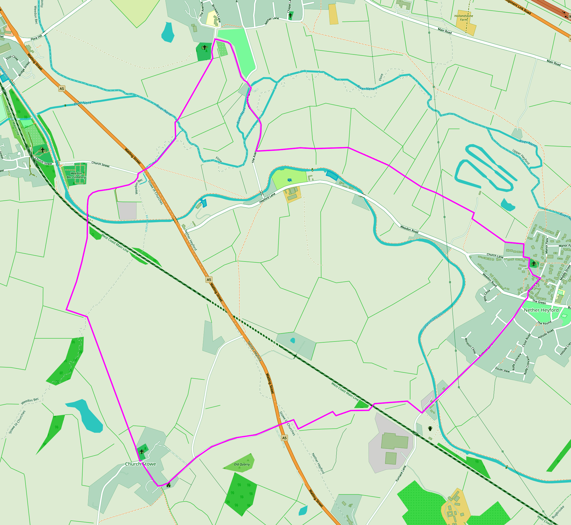
NB: The underlying map is © OpenStreetMap contributors and is used under their Terms.
Length: 8.1Km (5 miles)
Total Ascent: 107m
Time: 13/4 Hrs
NB: The underlying map is © OpenStreetMap contributors and is used under their Terms.
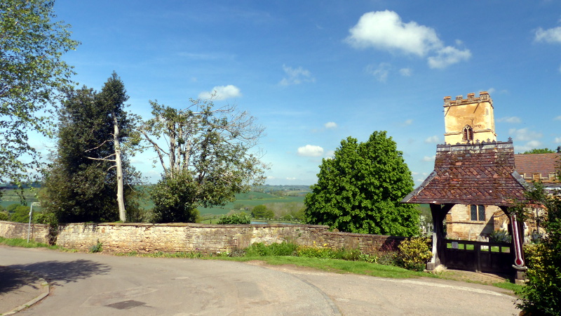
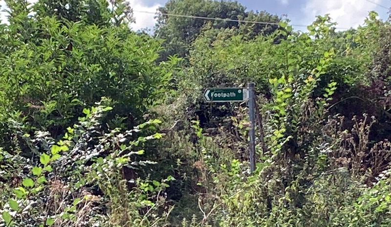
Waypoint 1.
The walk starts at St Michael’s Church Stowe. Careful parking is possible
on the road close to the church.
You will see a footpath sign just by a small wooden gate that to the left of
the lych gate. Once you are on the footpath, take a look up at the church tower
– you will be able to see two Saxon stones on the south and north corners
of the tower towards the bottom. They are believed to be part of a Saxon cross.
The one on the North corner (on the right as you look at the tower from the
footpath) was discovered during the restoration of St Michael’s in
2020.
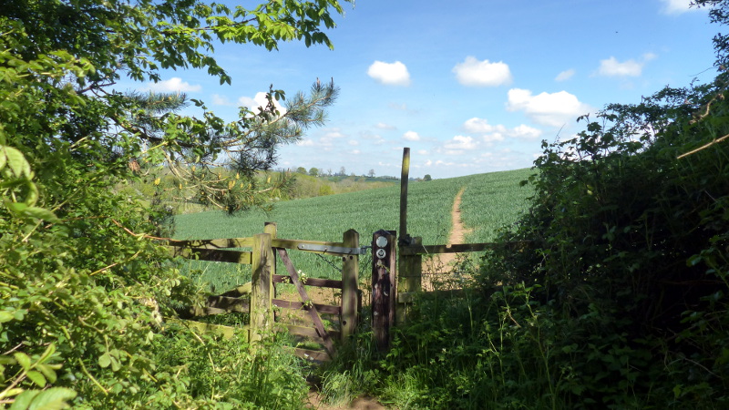
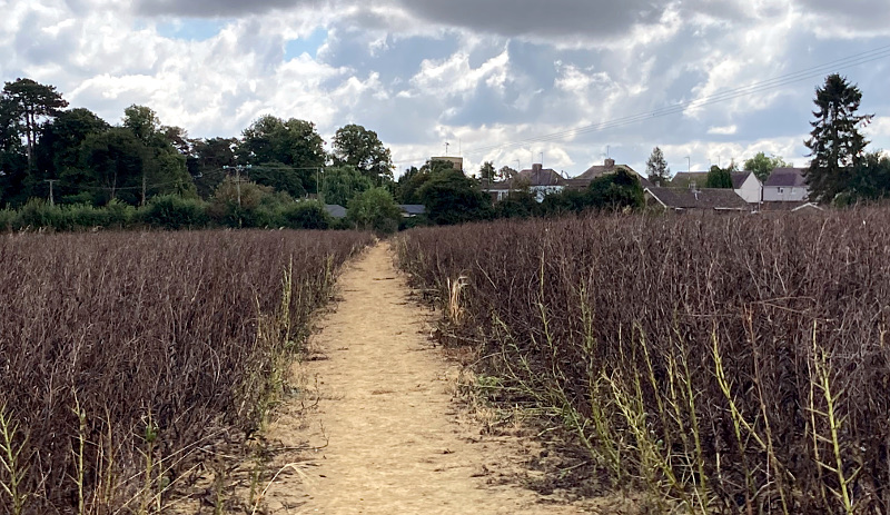
Waypoint 2.
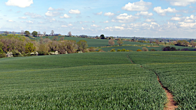
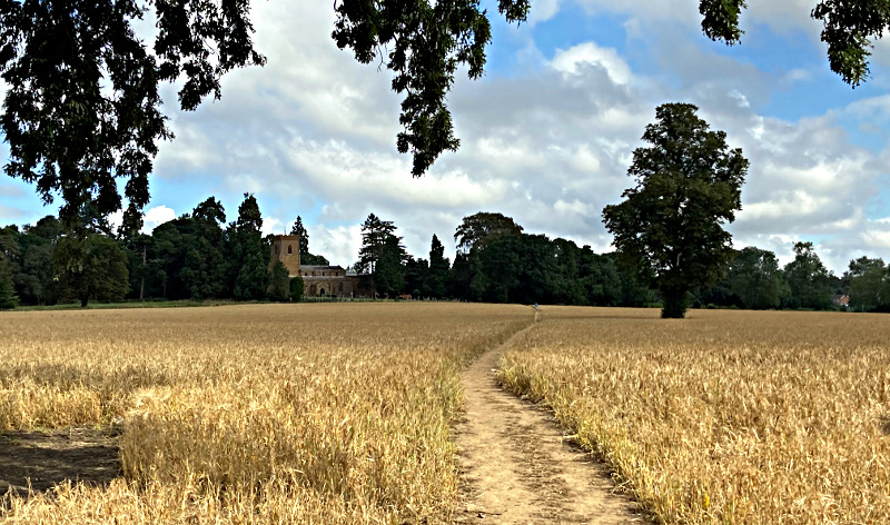
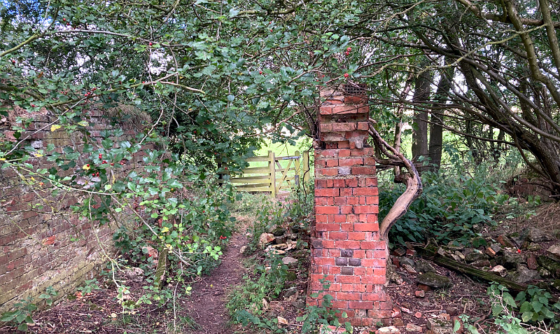
At the bottom of the hill, the path again passes through a small wooden gate
into a field of crops. During the late spring and summer the path is easily
visible through the crops, but is not well defined for a while after autumn
ploughing or sowing. The photo below shows the direction the path takes after
passing through the gate.
Waypoint 3:
After the brow of the hill in the field, the path heads slightly to the left
and downhill. The modest valley down to the left hand side of the path at this
point has been suggested as one of the possible sites of Boudicas last stand
against the Roman occupation. The Iceni and other tribes were heavily defeated
at this battle, even though they had considerably superior numbers. The battle
finally put an end to resistance against Roman occupation in the south of the
country. More information about it can be found here.
The path finally heads towards the nearest corner of the field beyond.
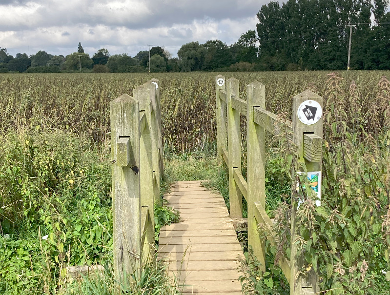
Waypoint 4&5.
On reaching the tree-line, proceed across the small bridge and straight on up
the field with the hedge on your left. At the top of the field, turn right and
follow the track
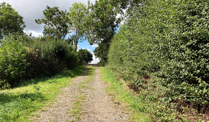
Waypoint 6.
Follow the track until you reach a metal gate with a small wooden gate to its
left. Pass through the gate, over the rail and then the canal bridge. Continue
along the gravel path until it joins the road just before the A5.
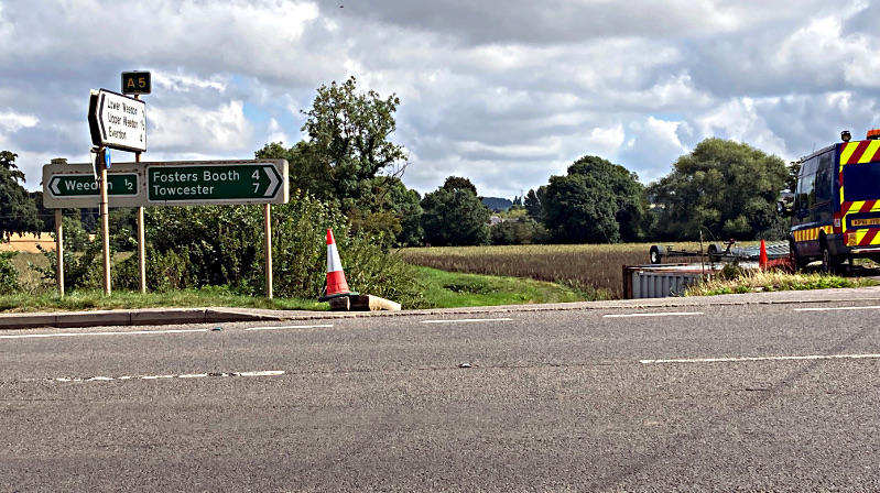
Waypoint 7:
Cross the A5 beside Clarke’s garage and follow the edge of the field
keeping the drainage ditch on your left.
Waypoint 8:
Near to the end of the field take the small bridge over the ditch and then turn
right to follow the edge of the field a short distance and then cross over the
stream via a concrete and metal bridge.
Waypoint 9.
Follow the path diagonally across the field – it is well marked. You will
then pass through a kissing gate to enter the churchyard of All Saints Flore,
which is well worth visiting.
Waypoint 10
Exit the churchyard and turn right at the road. Follow the road for some
distance, going over the bridge beside Flore mill, and then crossing a small
bridge over a stream.
Waypoint 11:
You will see a footpath finger post on your left point up through the hedge.
Take the path here, it is a little steep, with a stile at the top to enter a
field.
The path is well marked through a series of fields and pasture, it is easy
walking with one more stile to negotiate.
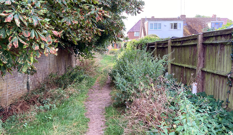
Waypoint 12.
You will eventually emerge at a gravel road, turn right at the road and then
after about 10 meters turn left to follow the path again through a field and
behind a series of gardens.
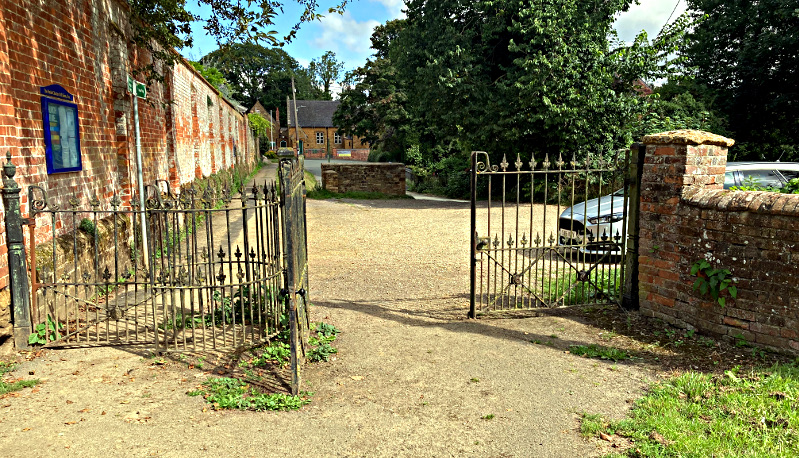
Waypoint 13.
At the end of the path there will be a wall in front of you, turn right and
follow the track until you join the road, where you will turn right.
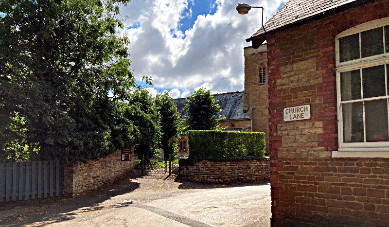
Waypoint 14.
You will be on Church Lane. The third church on this walk – St Peter and
St Paul, Nether Heyford will be in front of you, again worth visiting before
you rejoin the road to walk by some attractive houses.
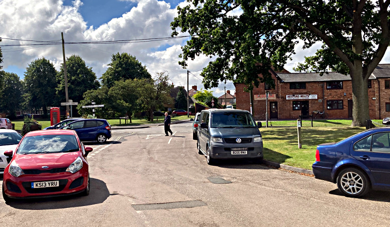
Waypoint 15.
At the green in Nether Heyford, you could stop at the village shop or the
Foresters Arms pub before continuing to take Furnace Lane up the hill out of
the village for about ¾ mile.
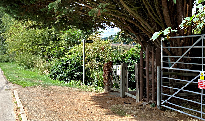
Waypoint 16.
Follow Furnace Lane over the canal bridge and then shortly after Tarry’s
coal merchant you will see a footpath finger post to your right. Take the path.
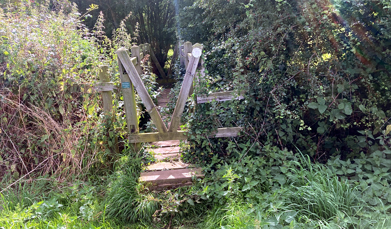
Waypoint 17.
After crossing a wooden bridge turn left and follow the edge of the field,
until you are by the railway line above you and you see a short low tunnel
under the railway line.
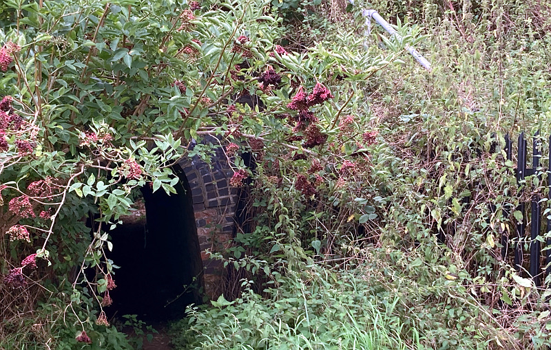
Waypoint 18.
Go through the tunnel, you will probably have to crouch a little, but it is a
short tunnel. When you emerge out the other end, turn right and take the path
first through trees and then a pasture. You will be walking beside the old
railway line that took the stones from the now disused quarry at Stowe down to
the canal at Heyford.
Waypoint 19.
When you see this gap, turn right through it and pass through the kissing gate,
and then turn left at the field. Keep to the edge of the field.
Waypoint 20.
You will arrive at this gravel path which takes you up to the A5.
Cross the A5 and then you will be walking back up to Church Stowe.
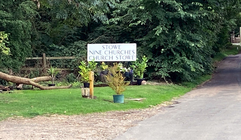
Waypoint 21.
Once you reach this sign follow the road back through Church Stowe to arrive
back at St Michael’s.