Upper Stowe - Church Stowe - Weedon - Field Path Round
Length: 6.25Km
Total Ascent: 140m
Number of stiles: 4 (some quite a stretch).
Time: 11/2 Hrs
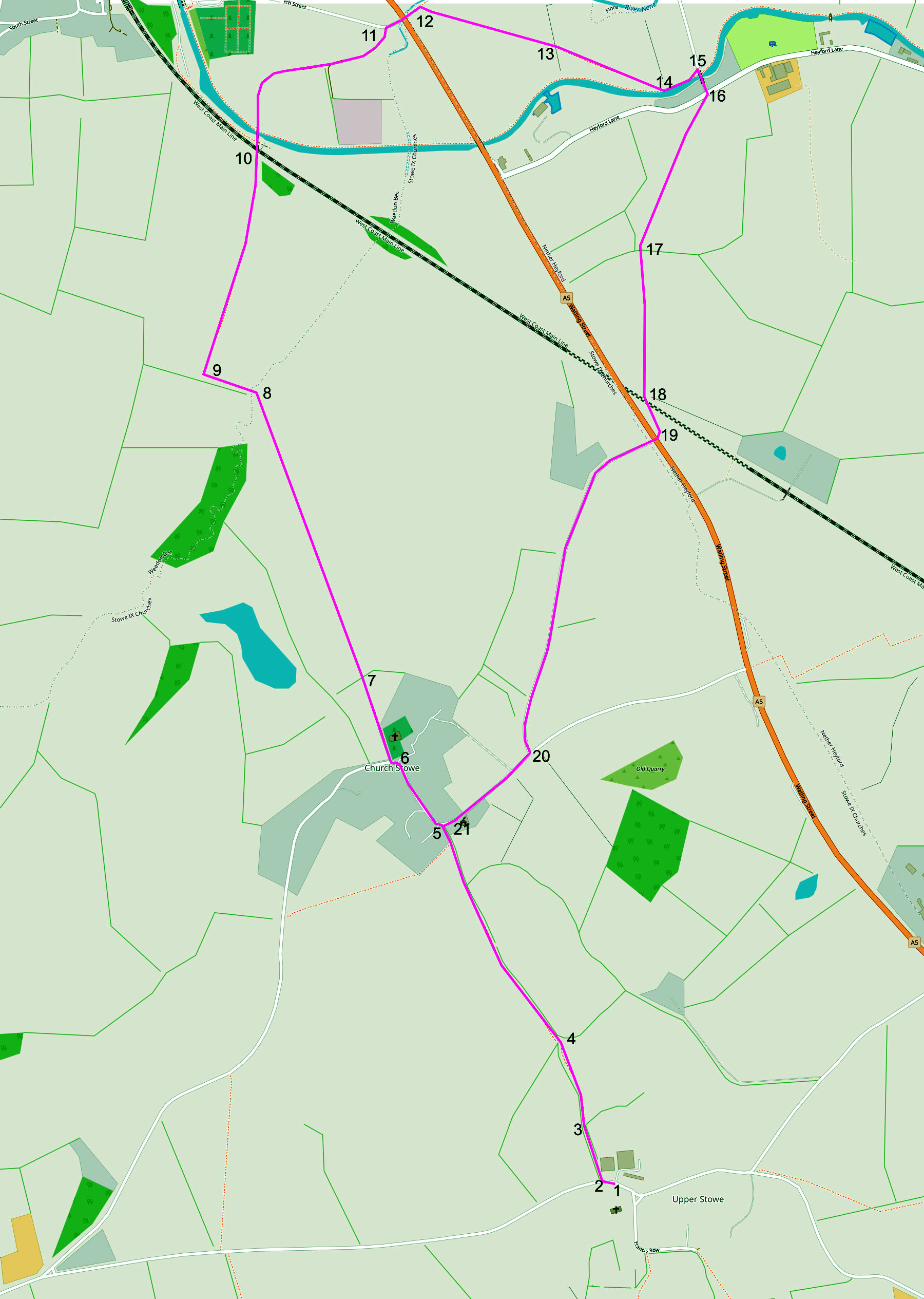
NB: The underlying map is © OpenStreetMap contributors and is used under their Terms.
Length: 6.25Km
Total Ascent: 140m
Number of stiles: 4 (some quite a stretch).
Time: 11/2 Hrs
NB: The underlying map is © OpenStreetMap contributors and is used under their Terms.
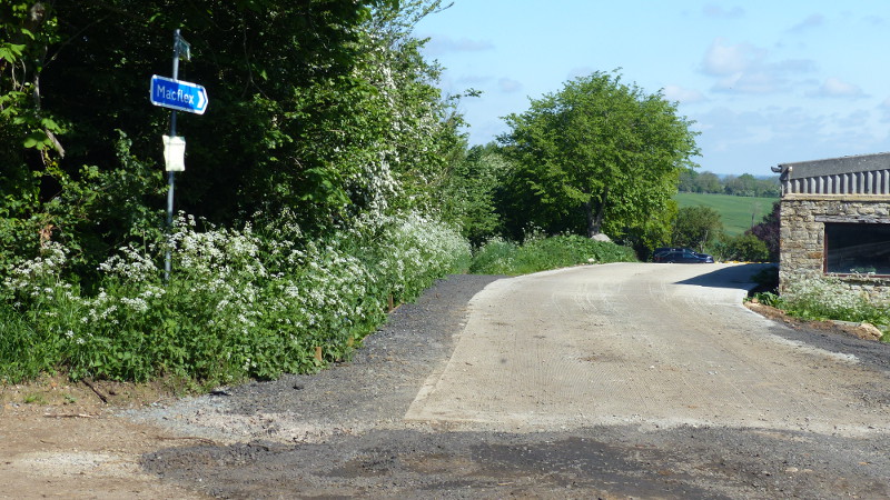
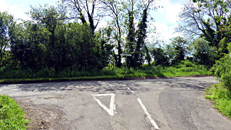
Waypoint 1.
The walk starts at the Old Dairy Farm Craft
Centre. Leave the car park onto the road and turn right. In 20 metres take
the gravelled footpath off to the right down between the trees.
Waypoint 2.
After a further 50 metres or so, the path passes through a small wooden gate
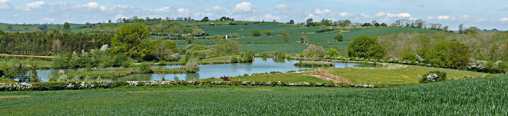
into a field with sweeping views over to Church Stowe (straight ahead) and over
to Northampton in the distance to the right.
Waypoint 4:
Carry on down to the bottom of the field where the path passes through a
second small wooden gate and climbs the hill towards Church Stowe.

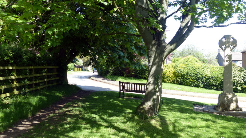
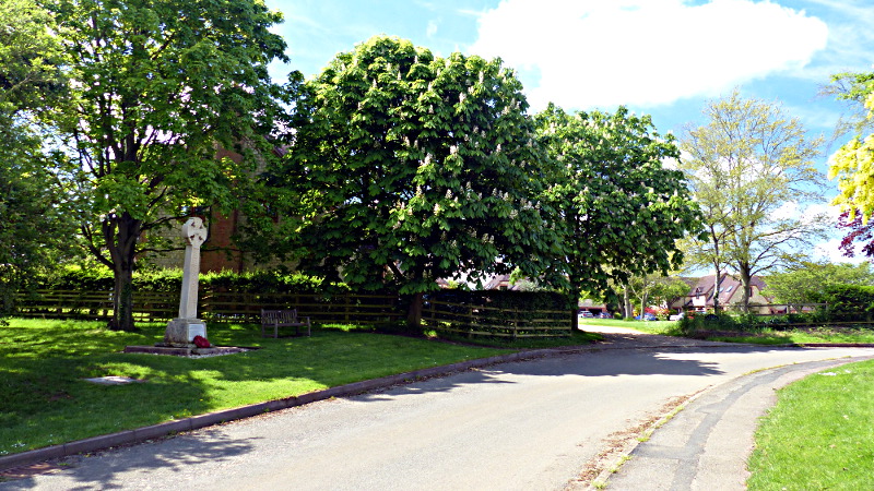
Waypoint 5.
At the top of the hill, go through a third small wooden gate and follow the
path straight on past the bench and war memorial onto the road through Church
Stowe.
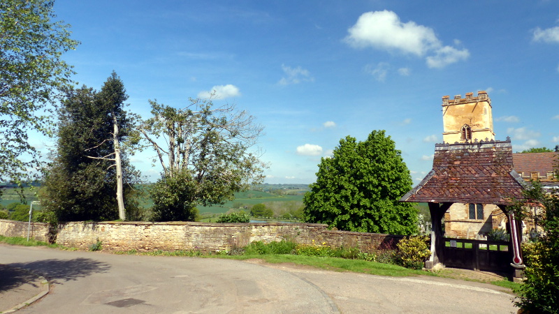
Waypoint 6.
After 100 metres, the road will lead you to St. Michaels' Church (straight
ahead). The signposted footpath that we are following leaves the road just past
the church on the right. The path leads downhill past the church.
It is well worth paying the church a visit before moving on (alternatively
you could visit near the end of the walk as the return route passes within 100m
of the church). The tower is of Saxon origins and is over 1000 years old.
Inside the church are two notable tombs on either side of the altar - one of a
12th century knight who was also lord of the manor of Stowe Nine Churches which
had been gifted to his forbears by William the Conqueror. The second very fine
tomb is that of Lady Elizabeth Carey. She was a descendant of the knight, and
the tomb was carved by Nicholas Stone.
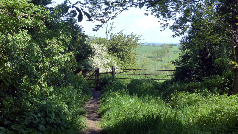
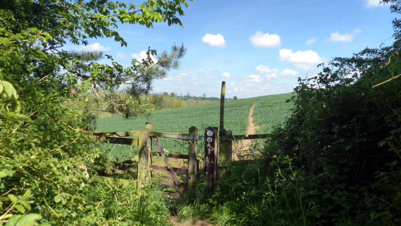
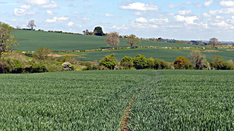
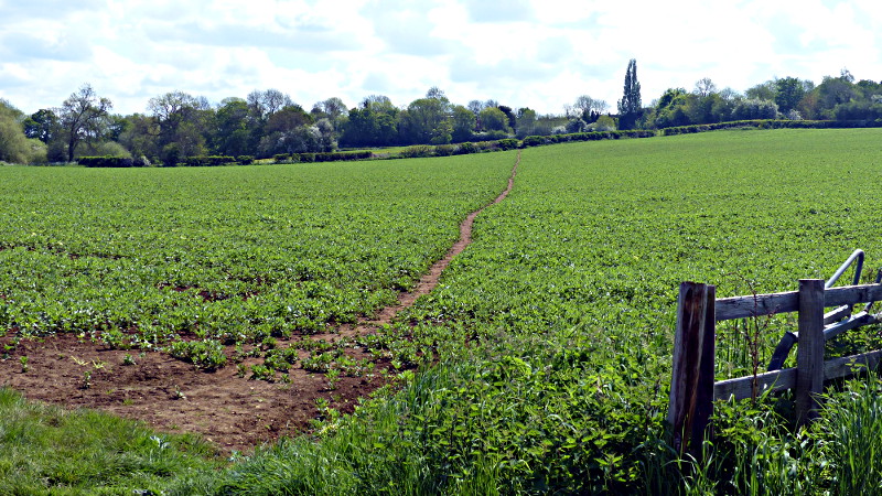
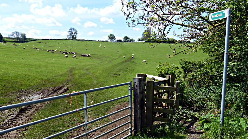
Waypoint 7:
At the bottom of the hill, the path again passes through a small wooden gate
into a field of crops. During the late spring and summer the path is easily
visible through the crops, but is not well defined for a while after autumn
ploughing or sowing. The photo below shows the direction the path takes after
passing through the gate.
Waypoint 8:
After the brow of the hill in the field, the path heads slightly to the left
and downhill. The modest valley down to the left hand side of the path at this
point has been suggested as one of the possible sites of Boudicas last stand
against the Roman occupation. The Iceni and other tribes were heavily defeated
at this battle, even though they had considerably superior numbers. The battle
finally put an end to resistance against Roman occupation in the south of the
country.
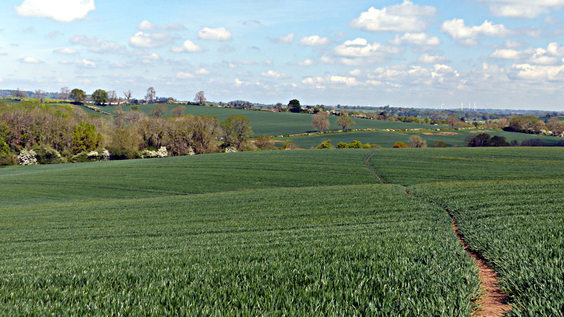
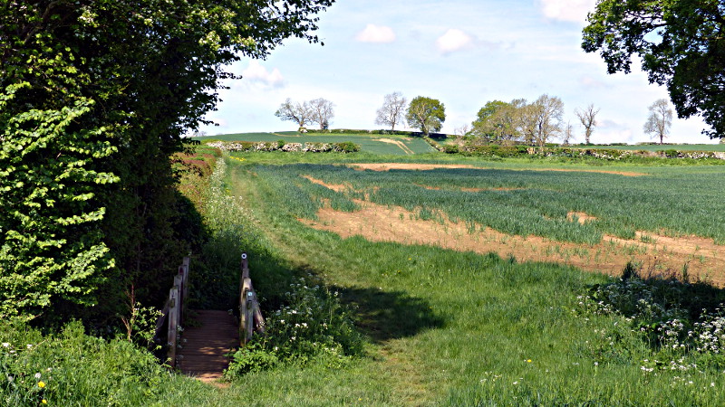
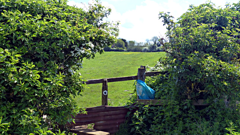
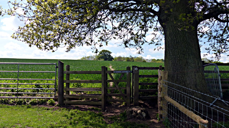
The path finally heads towards the nearest corner of the field beyond (photo below).
Waypoint 8&9
On reaching the tree-line, proceed across the small bridge and straight on
up the field with the hedge on your left. At the top of the field, turn right
and follow the track.
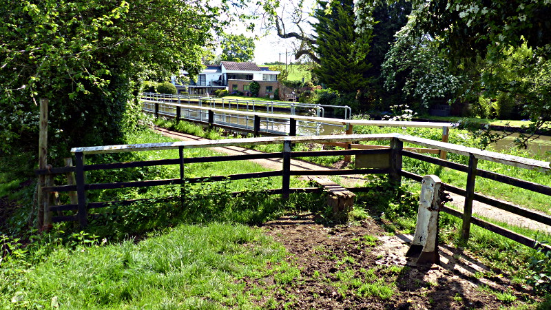
Waypoint 10:
Follow the track until you reach a metal gate with a small wooden gate to
its left. Pass through the gate, over the rail and then the canal bridge, and
continue to follow the track as it curves gently to the right towards the
A5.
Waypoint 11:
On reaching the A5, cross the road towards the road signs on the other side
just below Clarks garage. Go straight into the field using the path immediately
to the right of the road signs.
Waypoint 12:
Immediately past Clarks garage turn right and follow the path across the
field towards the stile in the hedgerow opposite.
Waypoint 13:
Climb the stile and follow the path diagonally across the next field to the
opposite right hand corner.
Waypoint 14:
Cross the stile and follow the canal tow path to the left.
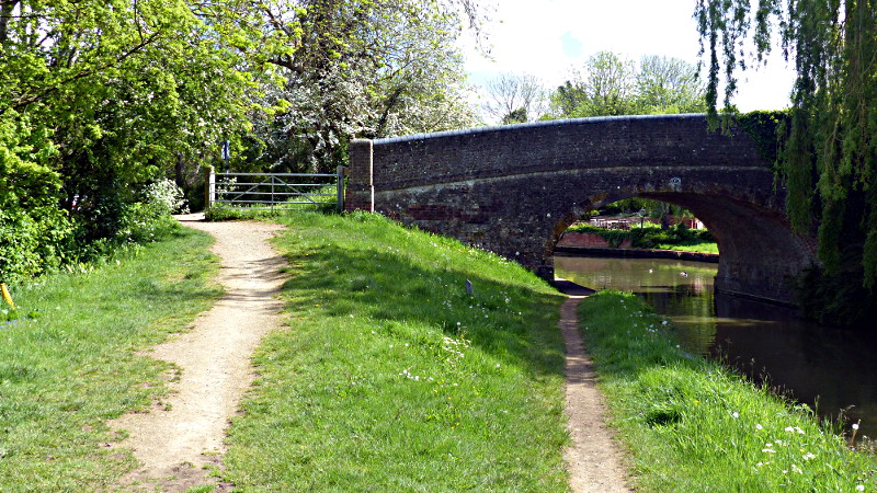
Waypoint 15:
Follow the towpath to the canal bridge (about 50m). Leave the towpath at the
bridge and turn right, over the bridge to a tee junction.
Waypoint 16:
Go straight across at the junction and into the field marked with the
footpath sign. The path follows the route of an old railway uphill to the top
right hand corner of the field.
Waypoint 17:
At the top of the field, pass through the gsate into the next field and head
towards the large tree on the other side of the field.
Waypoint 18:
Carry on past the large tree towards two stiles by a breather chimney for
the railway tunnel below. cross both stiles and turn right to follow the path
which runs parallel but about 20metres above the A5.
Waypoint 19:
Follow the path until it descends to meet the A5. At this point, cross the
A5 and follow the small road opposite signposted Church Stowe.
Waypoint 20:
Follow the Church Stowe as it climbs and turns right past Oaktreehill
Barn, a grade II Listed building dating from around 1860. The road ends in
a tee junction - turn right up the road towards Church Stowe.
Waypoint 21:
At the top of the road you will come to the war memorial which you passed
earlier in the walk. Turn left just past the memorial and re-trace your earlier
route across the path to Upper Stowe.
On arrival back at the Old Dairy farm, why not round the walk off with tea/cakes or perhaps lunch at the Barn Restaurant there?