Shortly after the Battle of Hastings in 1066, William the Conqueror confiscated English lands from their Saxon owners and gave them in parcels (estates) to his nobles. The estate at Stowe was given to John de Ghent by William (to whom he was related).
The entire estate, which stretched as far as Litchborough in the West, Nether Heyford in the East, and Weedon in the North, was passed by inheritance through many generations until in 1715 the then current owner, Lord Walton, died deeply in debt.
The entire estate was then purchased, as an investment, by an organisation called the Corporation of the Sons of the Clergy.
The Sons of the Clergy kept and administered the Stowe Estate until 1916. At this point it was broken into lots and put up for auction by Bidwells.
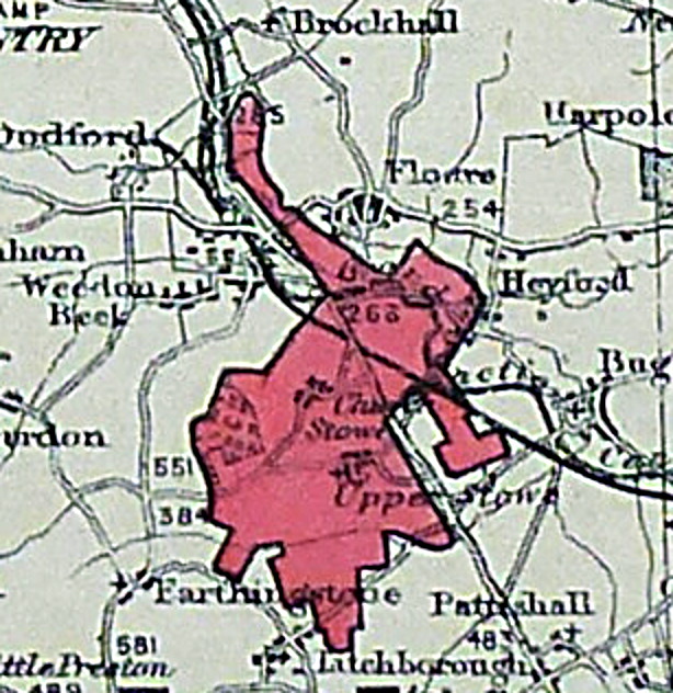
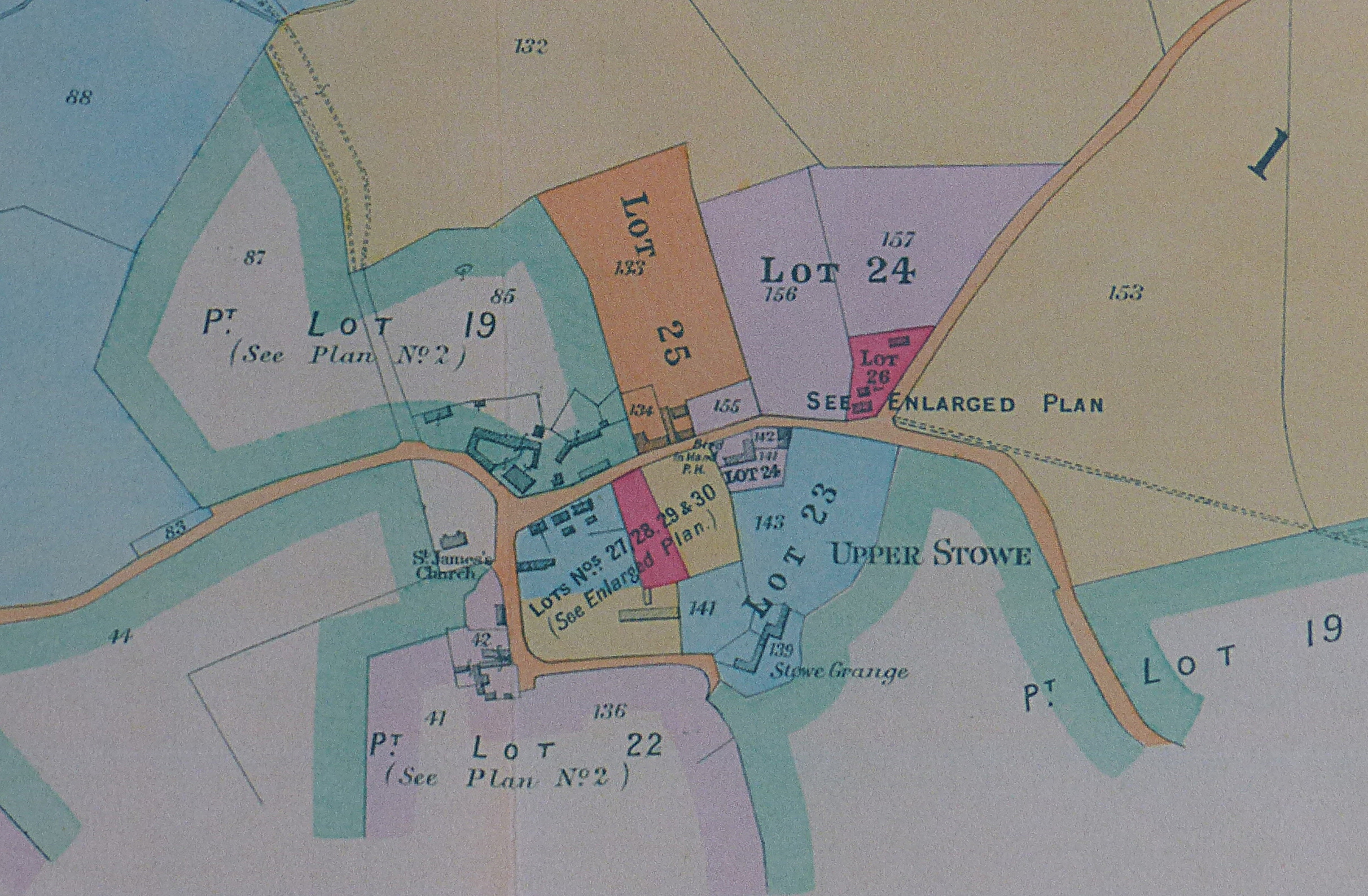
Auction Map showing the full extent of the estate.
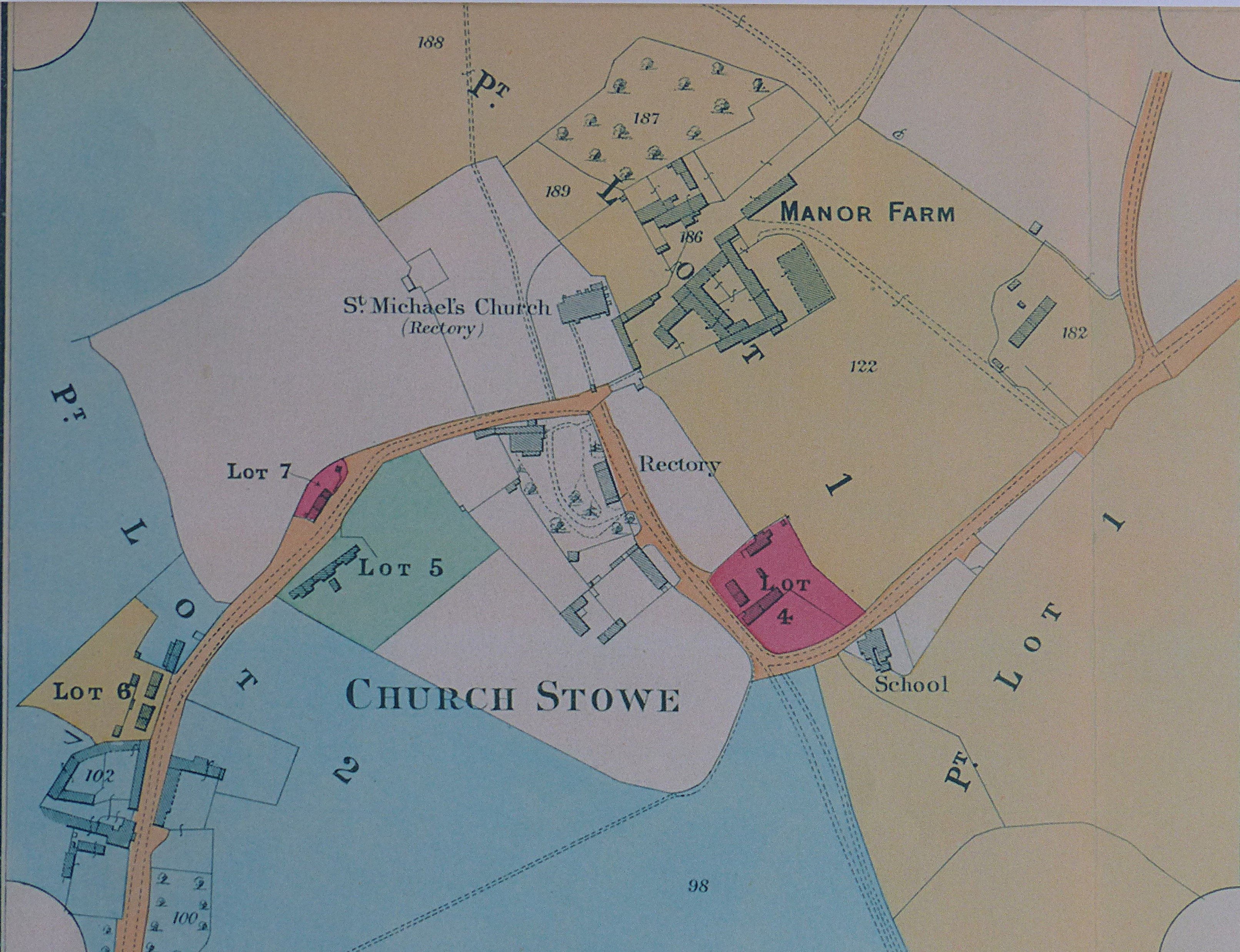
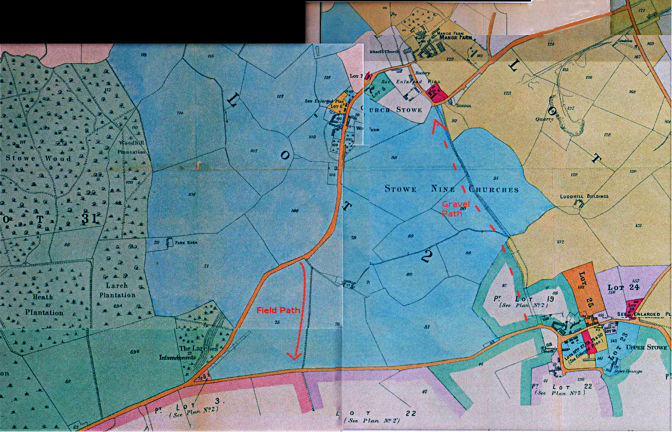
The map below is part of the Bidwell auction documents, showing the
village as it was in 1916 together with the lot boundaries, ready for
auction.
The walk is an 'auction trail' which takes you past the properties sold in the auction, firstly in Church Stowe, and then Upper Stowe. See if you can spot what's changed and what hasn't!
Start at the war memorial in Church Stowe, and follow the road towards the Church and then on through the village.
After passing the last house in the village, continue on up the road till you reach the track across the field on your left (shown on the auction map above), follow this field track to the Upper Stowe road and turn left to descend into Upper Stowe. (If the field path is muddy, you can continue on the road to the T-junction with the Upper Stowe road, again turning left to descend into Upper Stowe).
Lot 4: Five Labourers' Cottages.
So, starting in Church Stowe (detailed map above) by the war memorial, cross the road on the corner to lot 4 (in red on the map). In the auction catalog this lot is described as "Five Labourers' Cottages". These still exist. There are four stone and slate cottages in a terrace (now converted into two dwellings) alongside the road, with the fifth tucked away down a long drive just past the roadside terrace.
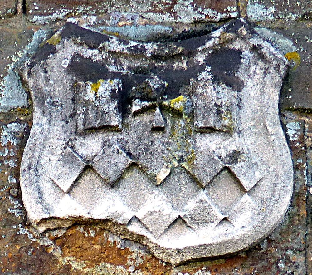
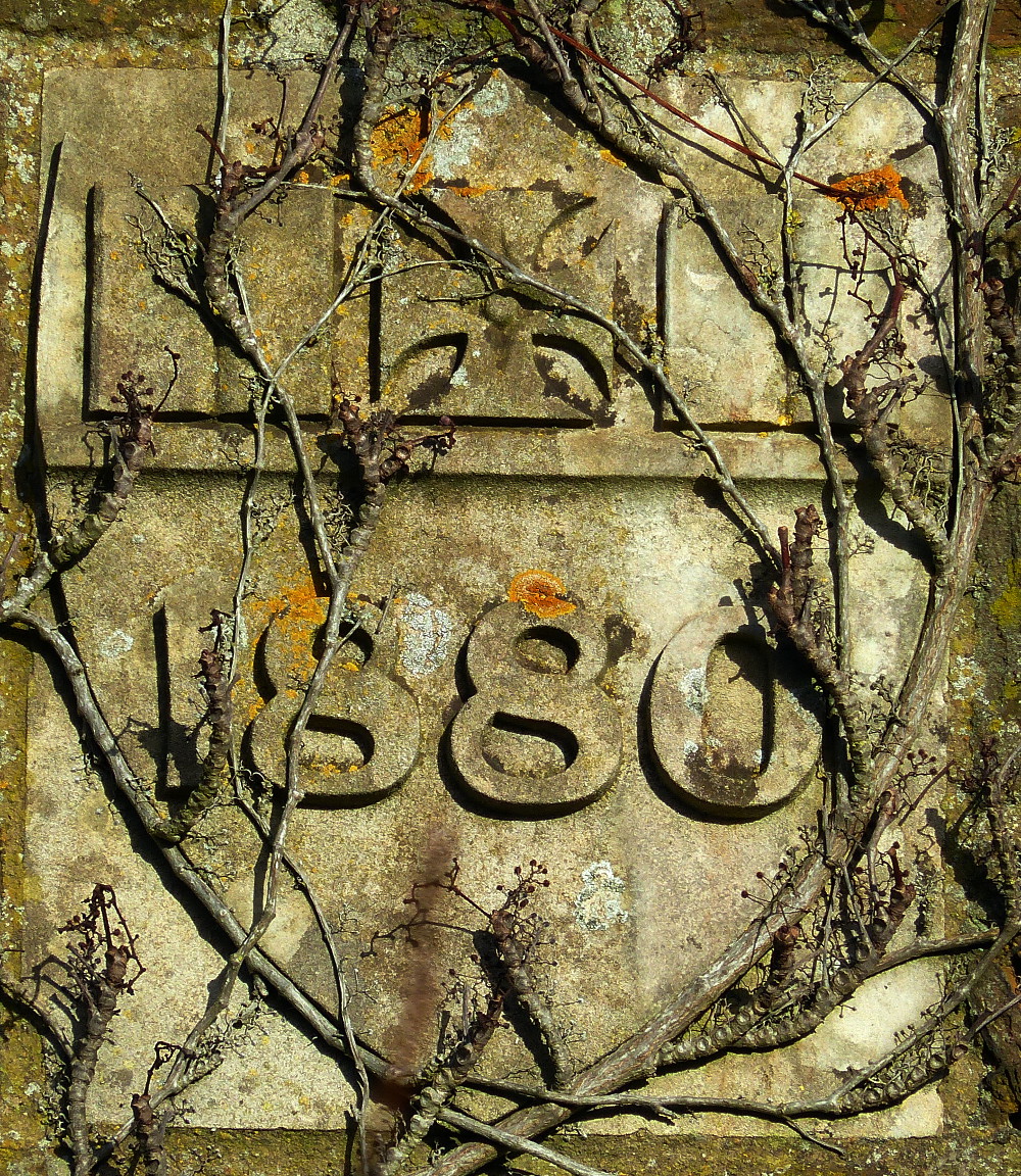
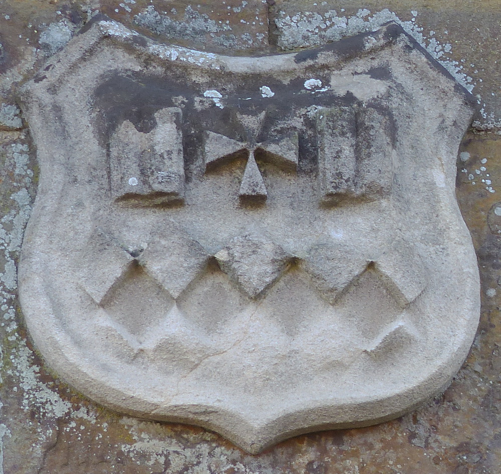
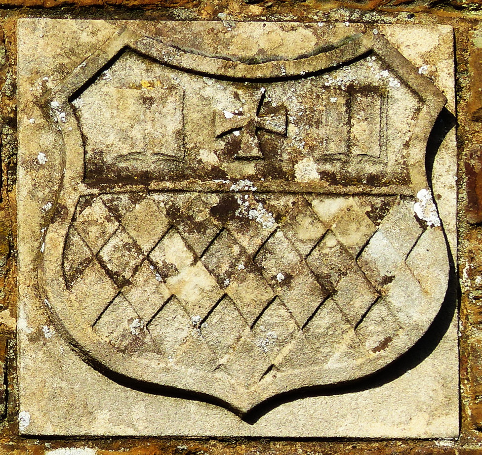
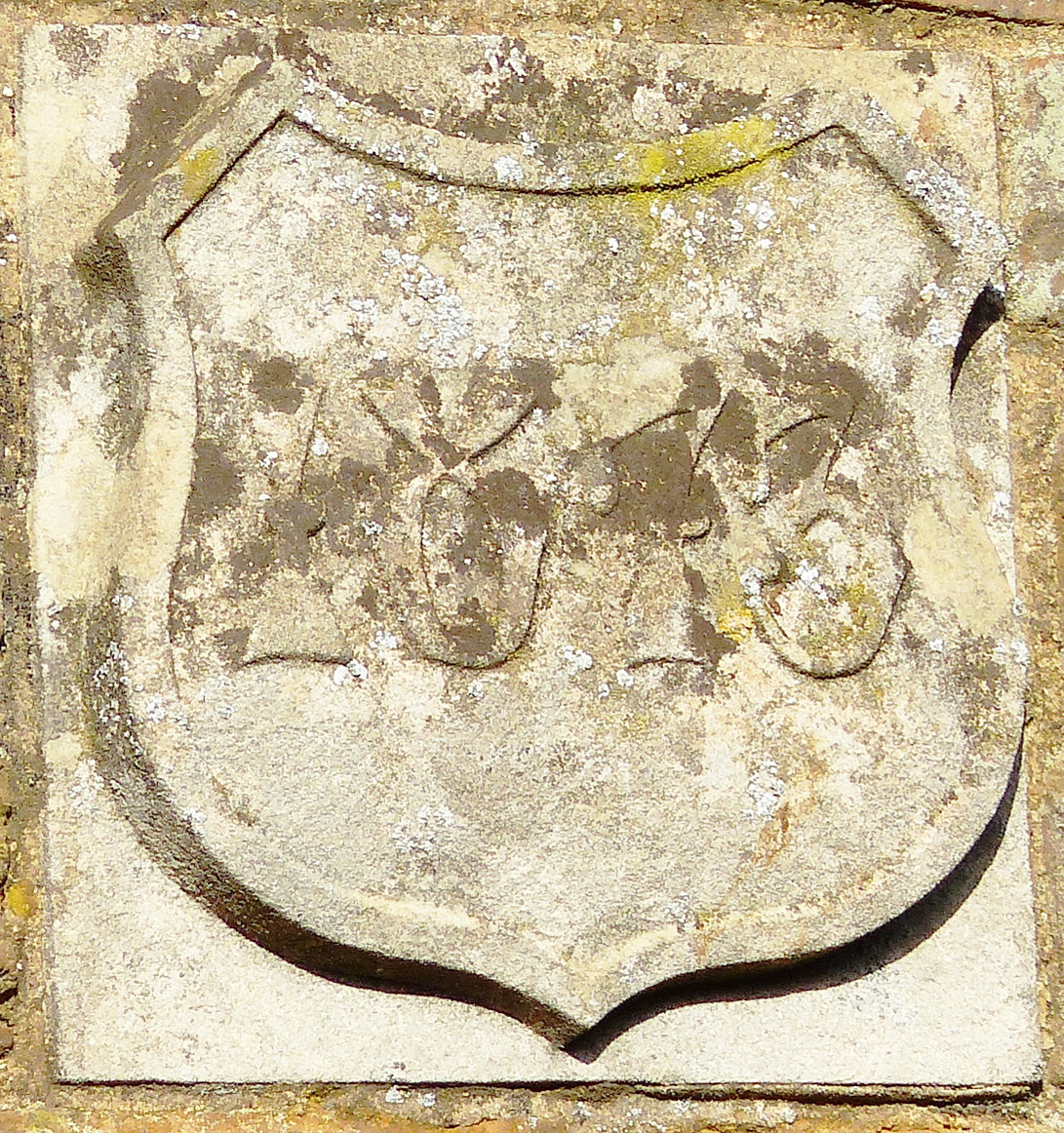
The cottages on the road carry the Coat of Arms of the "Corporation of the Sons of the Clergy", and a date plaque 1880.
Continuing towards the Church, we come to Lot 1, the "Manor Farm". The manor and its' barns and outbuildings (now converted into homes) lie down the private road which runs off to the right by the lychgate.
Continuing on from the church, the next lot (on the right) was described as a "pair of cottages". Although they have since been turned into a single dwelling, they still retain much of their original character - stone built under a thatched roof.
Lot 5: Six Cottages and Gardens.
Just beyond lot 7, and on the left side, lies Corporation Row - described as "Six Cottages and Gardens". It is likely that the cottages were originally built by the "Corporation of the Sons of the Clergy" - hence the name.
Lot 6: Two pair of Brick & Slate Cottages.
A short way beyond Corporation Row, on the right hand side of the road, we come to three sets of terraced cottages. The first of the three originally formed part of the large "Lot 2:Wood Farm". The next two were sold as Lot 6 - "Two pair of Brick and Slate Cottages".
Immediately beyond the brick and slate cottages, and on both sides of the road, lies "Lot 2: Wood Farm" consisting of stone built barns (now converted) on both sides of the road, followed by the Wood Farm farmhouse (now renamed) on the right hand side of the road.
We are now going to continue up the road to find the field path off to the left. All the land on both sides of the road out of Church Stowe were part of the Wood Farm lot.
Cross the field path and turn left onto the road and follow it down to
Upper Stowe.
As you enter Upper Stowe you will see on your left a large area of concrete with barns behind. The return path (the "Gravel Path") to Church Stowe descends the hill immediately to the left of the concrete. But don't go there yet! Instead follow the auction trail around Upper Stowe before returning to the "Gravel Path".
The barns are part of Lot 19: Dairy Farm, although the ones behind the concrete are later additions - the original stone built barns, just beyond the concrete, now serve as shops in the "Dairy Farm Craft Centre", and the original Farm House is immediately beyond these.
Before continuing down Main Street, take a detour down the lane to your right (past the church).
At the bottom of lane, where it turns sharp left, you will find (on the right) Lot 22: A Valuable Holding. The farmhouse and barns still follow the 1916 plan, although the barns have now all been converted into dwellings.
Continuing on down the lane, most of the houses on the left are more recent additions, built on land that was empty at the time of the auction.
Lot 30 Eight Cottages known as Francis Row.
Near the end of the lane on the left there is however a terrace of eight cottages, set well back from the road. At the time of the auction these eight cottages were known as "Francis Row". The whole lane has since inherited this name.
Continuing on from the cottages, right at the end of the lane, stands the final lot on "Frances Row" - Lot 23: Stowe Grange. The Grange still occupies the same footprint and retains the same character as at the time of the 1916 auction.
From here, retrace your footsteps up the the Dairy Farm, but on reaching the grass triangle, turn right ready to follow "Main Street" to the end.
Lot 29 Three Pair of Cottages.
Lot 29 "Three Pair of Cottages" is immediately on your right as you set off. The first pair, of stone and thatch construction, have since been converted into a single dwelling, and also extended, but the second and third pair retain much of their original character.
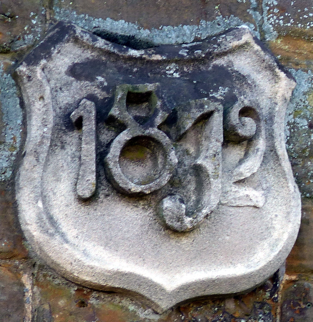
The matching second and third pair also bear the Coat of Arms of the "Corporation of the Sons of the Clergy", and date plaques showing they were erected in 1832.
Lot 28, "Pair of Cottages" is a little further along the road on the right. The white house called "Shepherd Lodge" now stands on this plot. It's not clear whether this is a reworking of the 1916 cottages, or whether it represents a rebuild.
Lot 25: Dwelling House, Bakehouse, Farm premises & Pasture Land.
The next lot (25) is on the left. This comprises the large stone and thatch house, and the following stone and slate bungalow (a conversion of the original barns which stood here). Directly opposite, across the road, is Lot 27.
Lot 27 originally consisted of three cottages. These have since been demolished and replaced with two detached dormer bungalows, and slightly further along the road a pair of semi-detached bungalows.
Lot 24: The "Bird in Hand" Public House, with Stables, and Paddocks.
Lot 24 is the next building on the right hand side of the road - the "Bird in Hand" public house. It was sold to Phipps brewery, and continued to operate as a public house until 1959 when it was finally closed and sold off. The two Haddonstone Bungalows across the road stand on land that was originally part of the lot 24 parcel, as do the modern house just past the Old Bird on the right hand side, and the two following modern builds on the left.
Lot 26: Pair of Cottages, Village Smithy and Land.
At the end of Main street, immediately before the sharp left hand bend is Lot 26. This lot comprised the the two stone and slated cottages (still retaining much of their original character) just before the bend, together with the village smithy which lies around the corner.
The two cottages again bear the Coat of Arms of the "Corporation of the Sons of the Clergy", this time with date plaques showing 1873 as the date of their construction.
To complete the walk, return to the Dairy farm, and take the "Gravel Path"
down to the right just past the concrete hard standing and the last barn.
This field track will return you to the war memorial in Church Stowe.